


Quick answer (as of November 2026) The Cumberland River runs east to west through Nashville and Davidson County on its 688-mile trip from eastern Kentucky to the Ohio River, per the U.S. Army Corps of Engineers. You can walk it on the Cumberland River Greenway, Shelby Bottoms and the John Seigenthaler Pedestrian Bridge, and put a boat or kayak in at Metro's ramps at Shelby Park, Lock Two and Peeler Park. Old Hickory Dam holds the river upstream of town and Cheatham Dam downstream. J. Percy Priest Lake is on the Stones River, a tributary. In May 2010 the river crested at 52.55 feet in Nashville, 12.55 feet over flood stage.
Most people see the Cumberland from Broadway or from the middle of the pedestrian bridge and never get closer than that. If you're moving here, it's worth knowing the river a little better: where you can walk it, where to put in a kayak, which lakes are actually on it, and how high it got in 2010. That last one is the part I want you to know before you buy a house near any creek in Middle Tennessee.
Does the Cumberland River go through Nashville?
Yes. The Cumberland River cuts through Davidson County from east to west, right past downtown Nashville, and the whole county drains into it, per Metro Parks. The Stones River joins it upriver of downtown, and the Harpeth River meets it farther downstream in Cheatham County.
The Corps of Engineers' Nashville District puts the river at 688 miles, from its headwaters in eastern Kentucky to the Ohio River near Smithland, Kentucky. Its basin covers more than 18,000 square miles in Tennessee and Kentucky, and by the time the water reaches the U.S. Geological Survey gauge downtown, 12,856 square miles of it are already draining past.
| The Cumberland at Nashville | Figure | Source |
|---|---|---|
| Length, headwaters to the Ohio River | 688 miles | U.S. Army Corps of Engineers, Nashville District (2025) |
| Basin | More than 18,000 square miles | U.S. Army Corps of Engineers, Nashville District |
| Area draining to the Nashville gauge | 12,856 square miles | USGS gauge 03431500, Cumberland River at Nashville |
| Paddling miles on the Cumberland in Davidson County | 51 miles | Metro Parks |
| Old Hickory Dam, upstream | River mile 216.2 | U.S. Army Corps of Engineers |
| Cheatham Dam, downstream | River mile 148.7 | U.S. Army Corps of Engineers |
| Flood stage at Nashville | 40 feet | National Weather Service |
| May 2010 crest | 52.55 feet, May 3, 2010 | National Weather Service |
| Record crest | 56.20 feet, 1927 | National Weather Service |
Can you walk along the Cumberland River in Nashville?
Yes. The Cumberland River Greenway follows the river through downtown, the John Seigenthaler Pedestrian Bridge crosses it to the East Bank, and Shelby Bottoms Greenway runs along about three miles of river frontage in East Nashville. All three are part of Metro Parks' greenway system.
The Cumberland River Greenway
Metro Parks builds the Cumberland River Greenway a piece at a time, and it's still growing as of November 2026. A 0.12-mile boardwalk beside Ascend Amphitheater, finished in the second quarter of 2026, keeps the greenway open during shows. New sections are going in alongside private projects at Modera Nations and at 900 1st Avenue North by the Stockyards.
Upriver, Metro is planning a 1-mile Opry Mills Greenway that ties the Cumberland River Pedestrian Bridge, the Cumberland River Greenway and the Stones River Greenway to Opry Mills. It has $11.3 million in federal funding, and Metro expects to start procurement in the fourth quarter of 2026. Nashville's 2011 Open Space Plan calls for protected land in each of the nine bends of the Cumberland.
The John Seigenthaler Pedestrian Bridge
The John Seigenthaler Pedestrian Bridge links downtown with the East Bank, and people walk and bike across it every day. Metro Parks still calls it the Shelby Street Pedestrian Bridge, after Dr. John Shelby, the same man Shelby Park is named for. Since September 19, 2016, Metro Public Works hasn't approved a full closure for any event, so even on a big event day there's a way across on foot or by bike.
Shelby Bottoms and Shelby Park
Shelby Bottoms Greenway and Natural Area is 960 acres in East Nashville with about three miles of Cumberland River frontage, over 5 miles of paved trail and over 5 miles of primitive trail. As of November 2026 it's free and open dawn to dusk every day. The main trailhead is at 1900 Davidson Street and the second one is at 2032 Forrest Green Drive.
Bikes stay on the paved trails, the greenway speed limit is 15 mph, and fishing isn't allowed in the natural area. Shelby Park sits right next to it: 300 acres two miles from downtown, open daily from dawn to 11 p.m., with a boat ramp on the river. Together the two cover more than 1,200 acres.
Where is Riverfront Park in Nashville?
Riverfront Park is on the downtown bank of the Cumberland River at 100 1st Avenue North and South, per Metro Parks. Across the river on the East Bank, the park Metro used to call Cumberland Park is now Wasioto Park, at 592 South 1st Street. The Metro Parks Board approved the new name on December 3, 2024, so older maps still show Cumberland Park.
Where can you launch a kayak or boat on the Cumberland River in Nashville?
Metro Parks runs three concrete boat ramps on the Cumberland in Davidson County: Shelby Park at river mile 193, Lock Two on Pennington Bend at mile 201 and Peeler Park on Neeley's Bend at mile 205. A fourth Metro ramp, Heartland in Donelson, puts you on the Stones River and is managed jointly with the Tennessee Wildlife Resources Agency (TWRA).
| Ramp | Address | Water | River mile | Parking | Lights | Restroom |
|---|---|---|---|---|---|---|
| Shelby Park | Shelby Avenue at 20th Street | Cumberland River | 193 | 4 spaces, paved | Yes | Yes |
| Lock Two | 2650 Lock Two Road, Donelson | Cumberland River | 201 | 19 spaces, paved | Yes | No |
| Peeler Park | 2043 Neeley's Bend Road | Cumberland River | 205 | 20 spaces, paved | Yes | Yes |
| Heartland | 3135 Heartland Drive, Donelson | Stones River | Not listed | 10 spaces, gravel | No | No |
Ramp details: Metro Parks boat ramp page, as of November 2026.
For canoes and kayaks, Metro counts 87.1 miles of paddling from public access points in Davidson County, and 51 of those miles are on the Cumberland. The rest are on Mill Creek (17 miles), the Harpeth (7.6), the Stones (6.6) and Whites Creek (4.9).
TWRA's paddlesports rules cover every canoe, kayak and paddleboard. You need a wearable life jacket within reach for each person, anyone under 13 has to wear one while underway (drifting counts), and you need a white light after sunset. If you were born after January 1, 1989, you need TWRA's boating education certification to run a boat with more than 8.5 horsepower.
I'm a Coast Guard veteran, so I'll say it plainly: wear the life jacket. The river has navigation locks at both dams, and Metro links the Coast Guard's Local Notice to Mariners right on its boat ramp page. Check it before you go out.
Which lakes and dams are on the Cumberland River near Nashville?
Two Corps of Engineers dams hold the Cumberland on either side of Nashville: Old Hickory Lock and Dam upstream at river mile 216.2 and Cheatham Lock and Dam downstream at mile 148.7. J. Percy Priest Lake isn't on the Cumberland. Its dam sits at mile 6.8 on the Stones River, a tributary that joins the Cumberland upriver of downtown.
| Dam and lake | River and mile | Counties | From Nashville, per the Corps | Size | Flood storage |
|---|---|---|---|---|---|
| Old Hickory Lock and Dam | Cumberland, mile 216.2 | Sumner and Davidson | About 25 miles upstream | 22,500 acres; the lake reaches 97.3 miles upstream to Cordell Hull Dam | None dedicated (run of the river) |
| Cheatham Lock and Dam | Cumberland, mile 148.7 | Cheatham | About 42 miles downstream, 9 miles below Ashland City | Lock chamber 110 by 800 feet, 26-foot lift | None dedicated (run of the river) |
| J. Percy Priest Dam | Stones River, mile 6.8 | Davidson, Rutherford and Wilson | Not given | 42-mile lake, 213 miles of shoreline, 14,200 acres at summer pool | Flood-control reservoir |
Sources: U.S. Army Corps of Engineers, Nashville District project pages and its March 2025 story on managing the Cumberland, as of November 2026.
The river through downtown runs between those two dams, which sit 67.5 river miles apart. The Shelby Park ramp at mile 193 is about 23 river miles below Old Hickory Dam.
A friend of mine has a place on the lake in Hendersonville, and it's a fun place to hang out in a beautiful part of Tennessee. TWRA lists more than 40 public boat access sites around Old Hickory, with no fees. My guide to things to do in Hendersonville covers the lake side of town. Downstream, past Cheatham, the Cumberland keeps going to Clarksville.
How high did the Cumberland River get in the 2010 Nashville flood?
The Cumberland River crested at 52.55 feet in Nashville on May 3, 2010, 12.55 feet above the 40-foot flood stage, per the National Weather Service. That's the highest since the upstream flood-control dams were built in the 1950s and 1960s, though still below the 1927 record of 56.20 feet.
The rain caused it. Nashville International Airport recorded 13.57 inches on May 1 and 2, more than double the old two-day record of 6.68 inches. The storm killed 18 people in Middle Tennessee.
The Corps of Engineers estimates its reservoirs prevented $430 million in damage in 2010. It also says plainly that reservoirs can't stop every flood, because their storage is limited and many tributaries aren't controlled at all. Old Hickory and Cheatham, the two dams on either side of Nashville, are run-of-the-river dams with no dedicated flood storage. J. Percy Priest, on the Stones, is one of the Corps' flood-control reservoirs.
How do I check if a Nashville house is in a flood zone?
Look up the address on FEMA's Flood Map Service Center, then check Metro's Parcel Viewer, which shows regulated floodplains and any elevation certificate on record. Metro Water Services' Development Services Division at 615-862-7225 will give you the FIRM zone, base flood elevation, whether the property is in a floodway and copies of elevation certificates on request.
The FEMA maps for Davidson County are free on the FEMA Flood Map Service Center. FEMA's Special Flood Hazard Area is the land a 1-percent-annual-chance flood covers, and Metro Water Services says a building inside it has a 26 percent chance of flooding over a standard 30-year mortgage. Metro also says a home outside it isn't guaranteed to stay dry.
Flood insurance is its own policy. A standard homeowner's policy doesn't cover flooding, and a new flood policy has a 30-day waiting period before coverage starts, per Metro Water Services. Price it while you're still in your inspection period, not the week before closing. The same FEMA site covers Williamson and Maury County addresses, so use it in Franklin, Thompson's Station and Spring Hill too.
Before you write an offer on a house near the Cumberland or any creek, I'll pull the FEMA map panel and ask Metro for any elevation certificate on file. If you're moving from another state, I'll record a video walkthrough of the house and the street and send you an unlisted YouTube link you can rewatch as often as you need. DM, text or call me at 615-392-1186.
Looking at homes near the Cumberland River?
If the river is part of why Nashville is on your list, start with my guide to moving to Nashville and the pros and cons of living in Nashville. If you'd rather live farther out and drive in, the Nashville suburbs compares 13 towns by drive, taxes and home prices, and how far Franklin is from Nashville has the real miles. For the city as a whole, see my Nashville page, and here's how I work with relocation buyers.
I live in Canterbury in Thompson's Station and made the move from California myself, so I know what it's like to pick a place from a few states away.
Frequently Asked Questions
Does the Cumberland River go through Nashville?
Yes. The Cumberland River cuts through Davidson County from east to west, right past downtown Nashville, and the whole county drains into it, per Metro Parks. The Stones River joins it upriver of downtown, and the Harpeth River meets it farther downstream in Cheatham County.
Can you walk along the Cumberland River in Nashville?
Yes. The Cumberland River Greenway follows the river through downtown, the John Seigenthaler Pedestrian Bridge crosses it to the East Bank, and Shelby Bottoms Greenway runs along about three miles of river frontage in East Nashville. All three are part of Metro Parks' greenway system.
Where can you launch a kayak or boat on the Cumberland River in Nashville?
Metro Parks runs three concrete boat ramps on the Cumberland in Davidson County: Shelby Park at river mile 193, Lock Two on Pennington Bend at mile 201 and Peeler Park on Neeley's Bend at mile 205. A fourth Metro ramp, Heartland in Donelson, puts you on the Stones River and is managed jointly with the Tennessee Wildlife Resources Agency (TWRA).
Which lakes and dams are on the Cumberland River near Nashville?
Two Corps of Engineers dams hold the Cumberland on either side of Nashville: Old Hickory Lock and Dam upstream at river mile 216.2 and Cheatham Lock and Dam downstream at mile 148.7. J. Percy Priest Lake isn't on the Cumberland. Its dam sits at mile 6.8 on the Stones River, a tributary that joins the Cumberland upriver of downtown.
How high did the Cumberland River get in the 2010 Nashville flood?
The Cumberland River crested at 52.55 feet in Nashville on May 3, 2010, 12.55 feet above the 40-foot flood stage, per the National Weather Service. That's the highest since the upstream flood-control dams were built in the 1950s and 1960s, though still below the 1927 record of 56.20 feet.
How do I check if a Nashville house is in a flood zone?
Look up the address on FEMA's Flood Map Service Center, then check Metro's Parcel Viewer, which shows regulated floodplains and any elevation certificate on record. Metro Water Services' Development Services Division at 615-862-7225 will give you the FIRM zone, base flood elevation, whether the property is in a floodway and copies of elevation certificates on request.
Tell me where you'll work and what you want close by, whether that's the river, a greenway or a lake, and I'll send you the homes that fit, with the flood zone checked on each one. DM, text or call 615-392-1186, or use the form below.
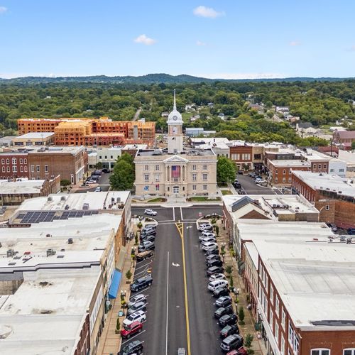
Header photo: Nashville from the Cumberland River, by King of Hearts, CC BY-SA 4.0, via Wikimedia Commons.
Check out this article next