

Quick answer (as of October 2026) Spring Hill, TN to Nashville is 37.8 road miles from City Hall to the State Capitol, about 47 minutes with no traffic, mostly on Saturn Parkway and I-65. Downtown Franklin is 13.7 miles and 22 minutes. CoolSprings Galleria is 22.2 miles and 27 minutes, and Nashville International Airport (BNA) is 40.8 miles and 49 minutes. The Census Bureau puts the average commute for Spring Hill workers at 30.0 minutes for 2020 to 2024. Your end of town matters: the same Nashville drive runs from 37 to 53 minutes depending on where in Spring Hill you start.
You've found a house you like in Spring Hill, and now you need to know if the drive works for your job. A map app gives you one number, for one address, at one hour. It won't show you how much that number moves from one end of town to the other, and in Spring Hill it moves a lot.
I live just north of here in Canterbury, in Thompson's Station, my office is at 231 Public Square in downtown Franklin, and I'm in Spring Hill every week. I've been selling real estate since 2013, with more than $500 million in career sales. Tell me where you work and I'll point you to the parts of town that fit the drive. DM me, text or call 615-392-1186.
How long is the commute from Spring Hill, TN?
The commute from Spring Hill, TN runs from about 6 minutes to the GM plant to about 49 minutes to Nashville International Airport, measured from City Hall with no traffic. City Hall, at 199 Town Center Parkway just off Main Street, sits on the Maury County side of the city.
| From Spring Hill City Hall to | Road miles | Minutes, no traffic | Main route |
|---|---|---|---|
| Tennessee State Capitol, downtown Nashville | 37.8 | 47 | Saturn Parkway, I-65 |
| CoolSprings Galleria, Cool Springs | 22.2 | 27 | Saturn Parkway, I-65 |
| Public Square, downtown Franklin | 13.7 | 22 | Highway 31 |
| Brentwood City Hall | 29.4 | 35 | Saturn Parkway, I-65 |
| GM Spring Hill Manufacturing, plant road at Highway 31 | 3.0 | 6 | Highway 31 (Main Street) |
| Nashville International Airport (BNA) | 40.8 | 49 | Saturn Parkway, I-65, I-440, I-40 |
| Maury County Courthouse, downtown Columbia | 11.3 | 18 | Highway 31 |
Those are OSRM routing figures, measured October 30, 2026, on empty roads, so read each one as the floor. GM's Spring Hill campus covers 2,100 acres, so your gate changes that row. I measured to where Donald F. Ephlin Parkway leaves Highway 31.
How far is Spring Hill, TN from Nashville?
Spring Hill, TN is about 38 road miles from downtown Nashville, measured from City Hall to the State Capitol. That's about 47 minutes with no traffic, by Main Street, Saturn Parkway and I-65 north. From June Lake Boulevard at I-65 Exit 55, on the Williamson County side, it's 29.7 miles and about 37 minutes.
Highway 31 is the other way in. Stay on it through Franklin and Brentwood to Concord Road, then pick up I-65, and City Hall to the Capitol is about 34 miles and roughly 55 minutes with no traffic. That's about 4 miles shorter and several minutes slower on an empty road, and it runs through both downtown Franklin and Brentwood.
How far is Spring Hill from Franklin, TN?
Spring Hill, TN is 13.7 road miles from downtown Franklin, about 22 minutes with no traffic, straight up Highway 31. That's City Hall to the Public Square, which is where my office is. Highway 31 is Main Street through Spring Hill and Columbia Pike north of it.
Cool Springs is a different drive. City Hall to CoolSprings Galleria is 22.2 miles and 27 minutes by Saturn Parkway and I-65, or 18.4 miles and 30 minutes by Highway 31 and the Goose Creek Bypass. From the north and east side of Spring Hill, I-65 wins for both: Keiser Street in Wades Grove is 15.7 miles and 22 minutes from the Public Square, and 16.5 miles and 23 minutes from the Galleria.
Which part of Spring Hill is closest to your job?
The northeast side of Spring Hill, TN is closest to Nashville, Cool Springs and Franklin, and the middle of town along Main Street is closest to the GM plant and Columbia. Here's the same list from five starting points, all with no traffic, as of October 30, 2026.
| Starting point (county) | State Capitol | CoolSprings Galleria | Franklin Public Square | GM plant road | BNA | Columbia courthouse |
|---|---|---|---|---|---|---|
| City Hall, Town Center Parkway (Maury) | 37.8 mi, 47 min | 22.2 mi, 27 min | 13.7 mi, 22 min | 3.0 mi, 6 min | 40.8 mi, 49 min | 11.3 mi, 18 min |
| Harvest Point Boulevard, west side (Maury) | 40.5 mi, 53 min | 24.9 mi, 34 min | 16.8 mi, 29 min | 5.9 mi, 13 min | 43.4 mi, 55 min | 13.0 mi, 25 min |
| Prescott Way, north side (Williamson) | 33.1 mi, 44 min | 17.5 mi, 25 min | 16.7 mi, 24 min | 5.5 mi, 12 min | 36.1 mi, 47 min | 13.8 mi, 24 min |
| Keiser Street, Wades Grove, east side (Williamson) | 32.1 mi, 42 min | 16.5 mi, 23 min | 15.7 mi, 22 min | 7.0 mi, 15 min | 35.1 mi, 45 min | 15.3 mi, 28 min |
| June Lake Boulevard at Exit 55, northeast side (Williamson) | 29.7 mi, 37 min | 14.1 mi, 18 min | 13.3 mi, 17 min | 9.3 mi, 13 min | 32.7 mi, 40 min | 18.7 mi, 23 min |
Spring Hill's county line runs through this table. Main Street crosses from Maury County into Williamson County just north of Beechcroft Road and Duplex Road, Duplex Road crosses it too, and Saturn Parkway stays in Maury County until about the I-65 interchange.
The street you're on picks your exit. For Nashville, both Maury side starts above use Saturn Parkway at Exit 53, and all three Williamson side starts use Exit 55. Going the other way, all three Williamson side starts reach Main Street or I-65 to get to the plant, so a north-end address gives some of its Nashville time back on a GM drive. My guide to what county Spring Hill, TN is in shows how to check any address.
What are the main commuting roads in Spring Hill, TN?
Spring Hill, TN has two I-65 exits and one main north-south road. These five roads carry the drives above.
- Saturn Parkway (State Route 396) runs from Main Street to I-65 at Exit 53, 5.5 miles and about 7 minutes from City Hall to the interstate ramp. It's the route to Nashville, Cool Springs and Brentwood from the middle and west side of town.
- I-65 is the fastest way north with no traffic, and the TDOT counts below show how much fuller it gets as you go.
- Highway 31 (State Route 6) is Main Street through town, Columbia Pike to the north and Nashville Highway to the south. It's the direct route to Franklin, to Columbia and to the GM plant road.
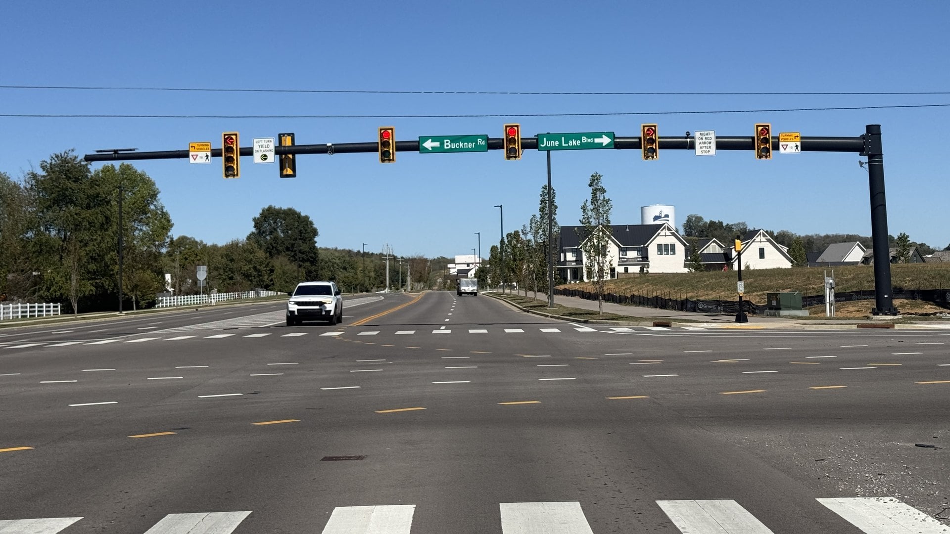
- Buckner Lane and June Lake Boulevard take the north and east side to I-65 at Exit 55. Buckner Road runs west from Buckner Lane toward Highway 31, and June Lake Boulevard runs east from it past the interchange.
- Port Royal Road crosses Saturn Parkway on the east side of town and passes the Route 95 bus lot at Kroger. I know that road from Fischer Park at Port Royal, where my kids played soccer, and football with the Spring Hill Hawks, who practice there.
Is the Buckner Road interchange open?
Yes. The I-65 interchange at Buckner Road in Spring Hill, TN opened to the public on May 31, 2024, per the City of Spring Hill, and it's Exit 55. It's a diverging diamond, which the City calls the third in Tennessee. The City put the total at $56.8 million, $30 million of it from the City and the rest shared with TDOT.
Before it opened, Saturn Parkway was Spring Hill's only direct connection to I-65. The new exit gives the north and east side a second way on, and on the east side of the interstate the road continues to Lewisburg Pike.
Exit 55 is the closer ramp only from the north and east side. City Hall is 5.5 miles and about 7 minutes from the Saturn Parkway ramp and 8.8 miles and about 12 minutes from the Exit 55 ramp. Keiser Street in Wades Grove is 3.1 miles and about 7 minutes from Exit 55.
How bad is rush-hour traffic in Spring Hill, TN?
Spring Hill, TN has no single rush-hour number, because the delay changes with the day, the hour and your direction. The Census Bureau puts the average commute at 30.0 minutes for Spring Hill workers for 2020 to 2024, against 27.9 for Williamson County, 29.0 for Maury County and 25.7 for Tennessee.
TDOT's 2025 traffic counts show where the volume builds. I-65 carries about 48,000 vehicles a day south of Saturn Parkway, about 75,000 between Saturn Parkway and Exit 55, and about 143,000 at Cool Springs.
| Road and location | Vehicles a day, 2025 |
|---|---|
| I-65 south of Saturn Parkway, Maury County | 47,861 |
| I-65 between Saturn Parkway and Exit 55 | 75,445 |
| I-65 north of Exit 55 | 85,915 |
| I-65 north of I-840 | 102,061 |
| I-65 at Cool Springs | 143,399 |
| I-65 at Brentwood | 159,402 |
| Saturn Parkway just west of I-65 | 39,245 |
| Main Street (Highway 31) near City Hall | 26,712 |
| Port Royal Road near Saturn Parkway | 20,113 |
| Highway 31 just south of the county line | 16,544 |
| June Lake Boulevard just west of I-65 | 16,303 |
| Buckner Road west of Buckner Lane | 11,039 |
Those are annual daily averages, both directions combined, so they show volume and don't show delay. Some are TDOT estimates rather than fresh field counts. TDOT says its I-65 widening is aimed at reducing delays between Saturn Parkway and I-840.
Before you buy, drive the route on a weekday at the hour you'd actually leave.
What road projects will change the Spring Hill commute?
The three projects that matter most for a Spring Hill, TN commute are TDOT's I-65 widening, TDOT's Highway 31 widening and the City's Buckner Lane widening. Here's where those stand, plus two earlier-stage items, on each agency's own page as of October 30, 2026. TDOT marks its dates as subject to change.
| Project | Agency | The work | Status |
|---|---|---|---|
| I-65 widening, north of Saturn Parkway to I-840 | TDOT | At least one more lane each way, plus auxiliary lanes from June Lake Boulevard to I-840 | In procurement. Design-builder award forecast for Q3 2027, construction scheduled for fiscal 2028 |
| Highway 31 (State Route 6), Beechcroft and Duplex roads to Tollgate Boulevard | TDOT | Two lanes to five, with a center turn lane | Under development. Construction scheduled for fiscal 2033 |
| Buckner Lane, Buckner Road to Duplex Road | City of Spring Hill | Two lanes to five, with a center turn lane | Under construction. The City's page, last updated October 2025, projects full completion in December 2026 |
| I-65 Corridor study, Thompson Lane to Bear Creek Pike | TDOT | Planning study of about 34 miles of I-65 on congestion and travel times | Public meetings held in August 2026. No construction dates |
| Port Royal Road, Saturn Parkway to Kedron Road | City of Spring Hill | Preliminary design and environmental study | The City hasn't allocated funding for construction |
TDOT's I-65 project also replaces the Thompson's Station Road overpass and the I-65 bridges over Lewisburg Pike. On Highway 31, TDOT has split the work at Thompson Ridge Road and Duplex Road, with right-of-way anticipated in fiscal 2028 south of that point and fiscal 2029 north of it.
Is there public transit from Spring Hill to Nashville?
Yes, one weekday commuter bus. WeGo Public Transit's Route 95 leaves the Spring Hill Kroger park-and-ride at 4900 Port Royal Road, stops at the Williamson County Ag Expo Park in Franklin and runs to WeGo Central in downtown Nashville. There's no commuter rail to Spring Hill. WeGo Star, the region's commuter train, runs between Lebanon and Nashville.
This is WeGo's Route 95 timetable dated July 5, 2026. There's no service on Saturdays, Sundays or holidays.
| Trip | Leaves | Ag Expo Park | Arrives |
|---|---|---|---|
| To Nashville, via West End | 5:45 a.m., Spring Hill Kroger | 6:05 a.m. | 7:08 a.m., WeGo Central |
| To Nashville | 5:51 a.m., Spring Hill Kroger | 6:11 a.m. | 6:55 a.m., WeGo Central |
| To Nashville | 6:17 a.m., Spring Hill Kroger | 6:41 a.m. | 7:25 a.m., WeGo Central |
| To Nashville, via West End | 6:32 a.m., Spring Hill Kroger | 6:57 a.m. | 8:00 a.m., WeGo Central |
| To Spring Hill | 3:40 p.m., WeGo Central | 4:24 p.m. | 4:44 p.m., Spring Hill Kroger |
| To Spring Hill, via West End | 4:00 p.m., WeGo Central | 5:14 p.m. | 5:34 p.m., Spring Hill Kroger |
| To Spring Hill | 4:10 p.m., WeGo Central | 5:02 p.m. | 5:22 p.m., Spring Hill Kroger |
| To Spring Hill, via West End | 4:58 p.m., WeGo Central | 6:12 p.m. | 6:32 p.m., Spring Hill Kroger |
That's the closest thing to a published rush-hour time I've found: 64 to 88 minutes into downtown in the morning and 64 to 94 back in the afternoon, against 34.1 miles and about 42 minutes for a car from the same lot to the State Capitol with no traffic. A bus isn't a car and it makes stops, so use that as a rough guide.
The timetable lists $4.25 for one regional ride and $73.50 for 20 rides, and active military and veterans ride free with a military ID. WeGo showed downtown detours on Route 95 as of October 30, 2026, so check its Route 95 page first. WeGo also lists a vanpool program, run by VanStar.
Does Spring Hill work for your job?
Spring Hill, TN works when the address, the exit and your departure time line up, and you can test that before you write an offer.
- Get the street address of your job and the hour you'd leave.
- Find your exit: Saturn Parkway, Exit 55 or Highway 31.
- Drive it on a weekday at that hour, both ways.
- Check the county for the address, since it sets the tax bill and the school district.
If a job is what's bringing you here, my guide to moving to Spring Hill for work covers GM, Ultium Cells and Medacta. For the rest of daily life, read living in Spring Hill and my Spring Hill, TN page.
Comparing towns? My Thompson's Station vs Spring Hill breakdown and Thompson's Station commute times run the same drives from the next town north, and how far Franklin is from Nashville picks it up from there.
Frequently asked questions about commuting from Spring Hill, TN
How far is Spring Hill, TN from Nashville?
Spring Hill City Hall is 37.8 road miles from the Tennessee State Capitol in downtown Nashville, about 47 minutes with no traffic by Saturn Parkway and I-65. From June Lake Boulevard at I-65 Exit 55, it's 29.7 miles and about 37 minutes. Add time at rush hour.
How far is Spring Hill from Franklin, TN?
Spring Hill City Hall is 13.7 road miles from the Public Square in downtown Franklin, about 22 minutes with no traffic by Highway 31. CoolSprings Galleria is 22.2 miles and about 27 minutes by Saturn Parkway and I-65.
How far is Spring Hill, TN from the Nashville airport?
Spring Hill City Hall is 40.8 road miles from Nashville International Airport (BNA), about 49 minutes with no traffic by Saturn Parkway, I-65, I-440 and I-40. From June Lake Boulevard at I-65 Exit 55, it's 32.7 miles and about 40 minutes.
What is the average commute in Spring Hill, TN?
The Census Bureau puts the average commute for Spring Hill workers at 30.0 minutes for 2020 to 2024. That compares with 27.9 minutes for Williamson County, 29.0 for Maury County and 25.7 for Tennessee.
Is the Buckner Road interchange open?
Yes. The I-65 interchange at Buckner Road in Spring Hill opened to the public on May 31, 2024, per the City of Spring Hill, and it's Exit 55. It's a diverging diamond that gives the city a second direct connection to I-65.
Is there a bus from Spring Hill to Nashville?
Yes. WeGo Public Transit's Route 95 is a weekday commuter bus from the Spring Hill Kroger park-and-ride at 4900 Port Royal Road to downtown Nashville, with four trips each way on the timetable dated July 5, 2026. There's no service on weekends or holidays, and no commuter rail to Spring Hill.
Not sure Spring Hill fits your commute?
Tell me where you work and what time you leave, and I'll point you to the parts of town that fit the drive. DM me, text or call 615-392-1186.
Check out this article next